Why Village Lanes Follow the Ground
Why village lanes follow the ground becomes clearer when you notice slopes, wet hollows, boundaries, and junctions—and learn what each clue can suggest.
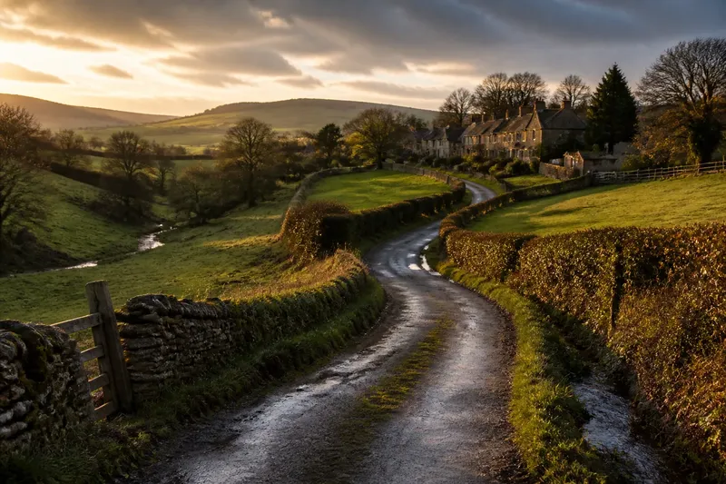
On a village walk, a lane may dip beside a hedge, curve around a low patch, then climb toward a row of cottages. Why village lanes follow the ground is often visible underfoot: slopes, drainage, and established routes can all shape a road’s course. The clues are useful, but they do not tell one universal story.
A lane’s bends often answer to the slope
A direct line up a hillside can be steep, awkward, or exposed to runoff. A lane that curves across the slope may gain height more gradually, while a route that follows a contour can avoid repeated climbs and descents. Look at the ground on both sides: a bank rising close to one edge and a view falling away on the other may reveal that the lane is traversing a hillside rather than heading straight over it.
Small changes in grade matter, too. A lane may bend around a shoulder of higher ground, where continuing straight would mean a sharper rise. At a low ridge, it might turn toward a shallow saddle—the lower passage between two higher points. The route can look indirect on a map yet feel natural when walked.
Compare the lane with nearby paths, field edges, and streams, but treat each as a clue rather than a verdict. A present-day track may have been altered, or the land beside it may have changed. A curve can reflect the shape of the hillside without proving exactly when or why it formed.
Notice whether the road climbs steadily or switches between short rises and level stretches.
Wet hollows leave a different set of clues
Water gathers in low ground and moves downhill, so lanes often respond to the places where runoff collects. A route may skirt a hollow rather than cross its wettest part. In other places, it may pass over a small rise before dropping toward a stream, keeping the road away from the lowest ground for part of its course.
After rain, watch where water travels without stepping into the road or obstructing others. A shallow channel beside the verge, a culvert beneath the lane, or a ditch following a hedge can show how water is carried away. If the road surface looks patchy or the verge is soft, that may reflect ordinary weather, maintenance, or the soil—not necessarily an old drainage choice.
Some lanes cross a stream at a convenient narrow point; others follow the valley for a while and cross farther on. Bridges, culverts, and low crossings are practical features, but their presence alone does not establish the route’s age. A crossing may have been replaced, moved, or built to serve a later road.
On a rainy walk, keep to the path and observe from a safe place; flowing water can make a familiar-looking dip hazardous.
Older routes can bend around boundaries
Not every curve is a response to terrain. A lane may follow an old boundary between fields, trace the edge of a property, or connect places that mattered to local travel. When a hedge and road curve together, the boundary may help explain the alignment, though hedges can also be replanted or shifted.
Junctions offer another clue. A narrow lane joining a broader road at an angle may have developed as a link from a farm, cluster of houses, or neighboring settlement. Several routes meeting at an uneven junction can reflect connections made at different times, but the shape does not reveal a precise sequence by itself.
Imagine a lane that bends around a wet hollow, then meets a track beside a long hedge. If the hedge and track both continue toward nearby fields, the landscape suggests two practical influences: avoiding the low ground and following a boundary or access route. That is a careful reading of visible clues, not proof of the lane’s full history.
Look for how a junction connects places, not just how its arms meet.
Why do village lanes vary so much?
Why does a lane curve when the hillside looks gentle?
A gentle-looking slope can still have small ridges, hollows, or changes in level that affect a route. A lane may also follow a boundary or connect buildings that are no longer obvious from the road.
Does a straight lane mean it is newer?
Not necessarily. Straightness alone cannot date a road, and a route may have been improved or realigned over time. Compare its position with the land and nearby features before drawing conclusions.
What can a roadside ditch tell me?
A ditch can show where runoff is being managed, especially when it leads toward a culvert or stream. It may be a later maintenance feature, so it does not by itself explain the lane’s original course.
Why might several lanes meet at an odd angle?
Each route may connect a different set of homes, fields, or neighboring places, producing a junction that grew by addition rather than from a single plan. Later changes can make the meeting point look even less regular. Follow each arm’s direction and note what it reaches; a link toward a farm or field can suggest its purpose, while the angle alone cannot reveal when the routes joined.
Read the route without turning clues into a story
A useful way to read a lane is to make a few quiet observations while walking. Note the direction of the slope, the nearest low ground, and whether the road seems to follow a hedge or stream. Then check where it leads: toward a bridge, a cluster of buildings, open fields, or another road.
Keep observation separate from inference. “The lane bends around a hollow” describes something you can see. “The bend was made to avoid flooding” is a possible explanation, but it needs more evidence than the curve alone. Several influences may overlap, and later repairs can blur the original pattern.
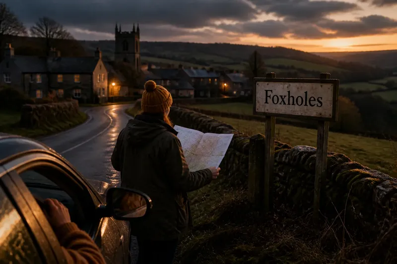
For a closer look, a walking map can help you compare the lane with contours, streams, and neighboring routes. On the ground, signs, gates, private drives, and local access rules matter more than curiosity; stay on permitted paths and do not enter private land to inspect a feature.
Choose one bend and ask what the ground does immediately before and after it.
The lane is part of a changing landscape
Village lanes are not frozen records. Surfaces are repaired, drains are renewed, boundaries shift, and traffic needs can prompt alterations. A smooth curve may contain several layers of change, while a rougher stretch may simply reflect current upkeep. The visible road is one part of a landscape that has been used and adjusted.
When you next walk a village lane, start with what is plain: the rise beneath your feet, the direction water would take, and the places the road joins. Why village lanes follow the ground is best answered one stretch at a time. A cautious reading can make an ordinary bend more legible without pretending that every lane shares the same past.